The plan goes out of date
A PDF does not reflect holds, sales or inventory changes in real time.
Present every lot in its real location, keep availability up to date and give your team a tool to explain, quote and sell.
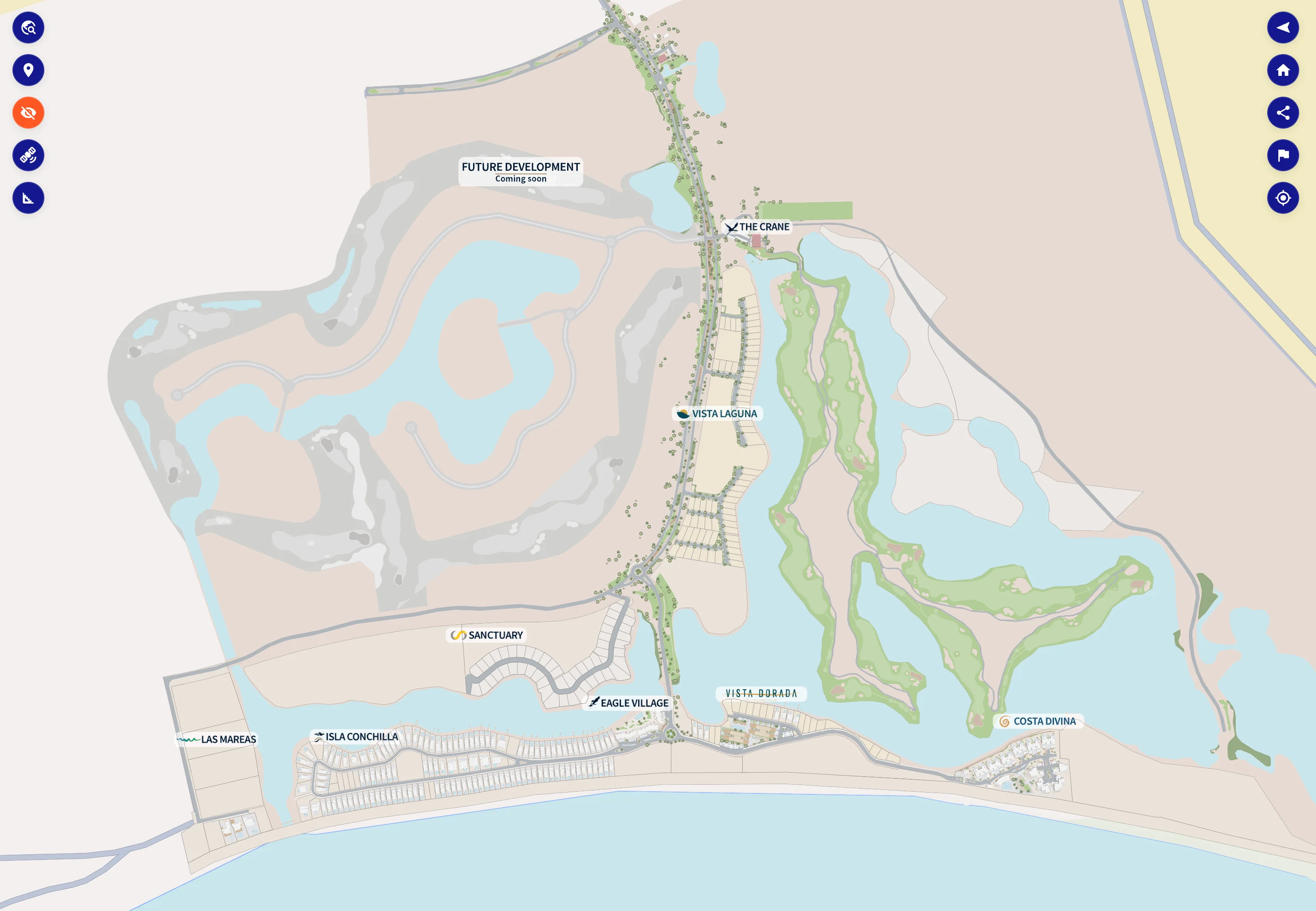
When the map, the inventory and the commercial information are separate, the team wastes time explaining and confirming.
A PDF does not reflect holds, sales or inventory changes in real time.
Pricing, areas and availability end up spread across files and people.
A prospect asks about a lot and the salesperson needs to verify before answering.
Without an interactive reference, comparing phases, amenities and lots takes more time.
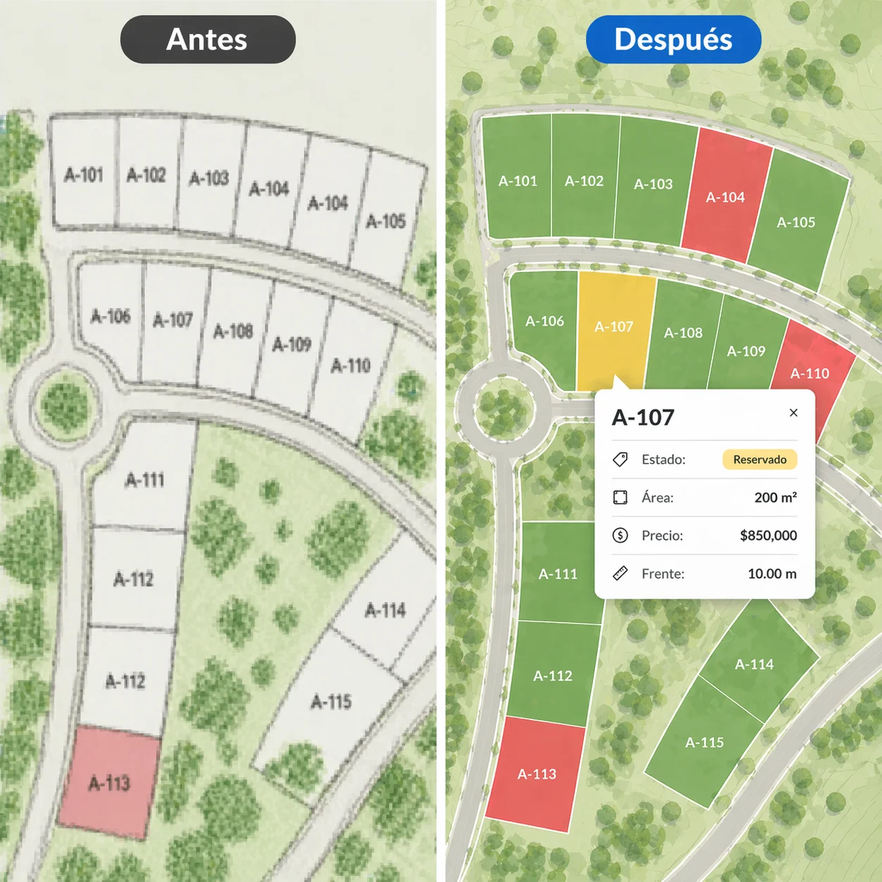 Visual, up-to-date inventory
Mapio turns your masterplan into an experience that is easy to explore. Every lot keeps its real location and gathers the information your team needs to present it.
The ease of a digital map, with the commercial information of your development.
You don't depend on us for every change. From the Mapio panel you can update the inventory and the commercial information shown on the map.
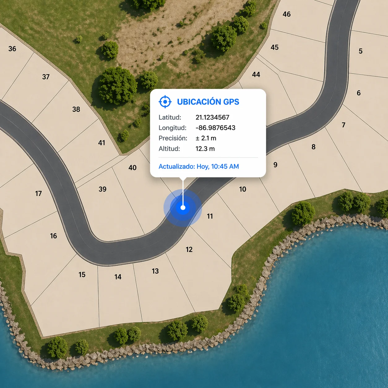
From their phone, the salesperson and the buyer can locate themselves on the development as they walk the site. No app to install.

We integrate Mapio with Zoho, HubSpot or your system via API so the prospect experience isn't isolated from your operation.
Mapio ships ready to use. Add-ons layer in new experience, capture and integration capabilities without switching platforms.
Embed immersive panoramas and points of interest inside the map to showcase amenities, facilities, views or key spaces.
Add a precise, up-to-date aerial image of the site, captured by drone and prepared to work as the visual base of the project.
Connect Mapio to Zoho, HubSpot or your own system via API to sync leads, activity and sales processes.
Add buildings, terrain and three-dimensional models to understand volume, context and architecture right on the map.
Open each map and tour it the way a prospect would from their phone or computer.
Beach residential with golf course. Real-time inventory, 360° panoramics and drone orthophotos across the entire development.
See live map →Luxury residential development with a digital elevation model built from real survey data, giving buyers precise terrain and lot context.
See live map →Self-hosted Mapio deployment — georeferenced lots with live status, pricing, and filters, all running on plain PHP hosting.
See live map →Massive master-planned community with 9,000 lots mapped and managed through a single interactive platform. Full inventory control at scale.
See live map →We start from your plans, data and sales process. We configure the experience, publish the map and support your team in operation.
Share the material you already have and we'll show you how to turn it into an interactive map.
Contact us